Showing posts with label Waterton. Show all posts

Saturday, 23 July 2016

Crypt Lake


Hike Name: Crypt Lake Trail
Activity: Hiking
Distance: 17.4km (RT)
Altitude: 1,996 m
Elevation Gain: 700m
Area: Waterton
Crew: Julia, Steph, Christine, Shahir, Jay, JJ, Trevor
Time to Lake: 2 hours
Lisa's Mom Rating: Yes
Trailhead: Waterton Ferry Port

Getting There:
Go to the Ferry Port in Waterton


Additional Info:
This is a very popular hike in Waterton National Park. We caught the 8AM ferry in town and after about 15 minutes, we were at Crypt Landing, the trailhead for the Crypt Lake Hike. The path is obvious and easy to follow. The first half of the hike is through a lush forest, and the view open up during the second half of the hike. There is a section with a ladder, tunnel, and chain bolted to the side of the mountain, which added to the experience of this trip! We spent about an hour and a half at the lake before heading back down.

 The final set of falls before the lake. Viewed from just after the tunnel.

 Relaxing at Crypt Lake

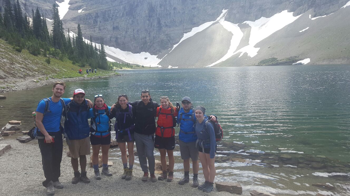
Team photo at Crypt Lake

Thursday, 30 June 2016

Alderson Lake (Overnight)


Hike Name: Alderson-Carthew Trail / Alderson Lake Overnight (Attempt)
Activity: Backcountry Camping/Backpacking
Total Distance: 23 km
# Nights: 1 0
Date: June 30 - July 1, 2016 June 30, 2016
Area: Waterton
Crew: Ben
Trailhead: Cameron Lake (free shuttle from Waterton Townsite to Alderson-Carthew trailhead). Hike through to Waterton Townsite


PLANNED Route: 
Day 1 - Cameron Lake to Alderson Lake (peak bag Mount Alderson on the way) (15km)
Night 1 - Alderson Lake Backcountry Campground
Day 2 - Summit Mount Carthew and Buchanan Peak then hike out to Waterton Townsite (7-10km)


We ditched our backpacks near the summit pass and took our day packs to peak-bag Mount Alderson. This would have been a leisurely and straight-forward hike to the summit, however we ran into a black bear ~1/2 way up and had to desert our attempt.
We grabbed our packs and continued down to Alderson Lake to set up our camp. After relaxing, re-filling water, and setting up our tent, we were ready to make dinner. However, the other couple at the campsite mentioned to us that one or two black bears had been poking around the campsite for an hour. We noticed there was a half-eaten package of beef jerky left at the food-prep area and wondered whether the bears have been eating the garbage left at the campground. We decided to pack up our tent and slog back into town (mainly because I was nervous).
We basically did complete our backpacking trip, just fast-forwarded through the sleeping portion and hiked out on the same day...


ACTUAL Route:
Day 1 - Cameron Lake to Alderson Lake (Mount Alderson attempt on the way). Set up at Alderson Lake Backcountry Campground for a few hours but pack up due to a black bear poking around for a while, hike through to Waterton Townsite. (23 km)
Night 1 - Thirsty Bear and sleep in Bennett's truck!


 Me and Bennett on our way up to the summit pass
 Beautiful colours on Mount Alderson (right)
 Bennett and a nice waterfall
Alderson Lake and Bennett


Wednesday, 29 June 2016

Bear Hump


Hike Name: Bear Hump
Activity: Hiking
Distance: 2.8 km (RT)
Altitude: 1,546 m
Elevation Gain: 225m
Area: Waterton
Crew: Ben
Time to Summit: 20 minutes
Lisa's Mom Rating: Yes
Trailhead: Waterton Visitor Center

Getting There:
Heading into Waterton, park at the Parks Canada visitor center.

Additional Info:
Bennett and I had a lovely sunset hike up the Bear Hump. We arrived in town around 8pm and after we set up camp (aka parked Bennett's truck), we decided to take a bottle of wine to the Bear Hump and watch the sunset.
 Bennett
Bennett and I