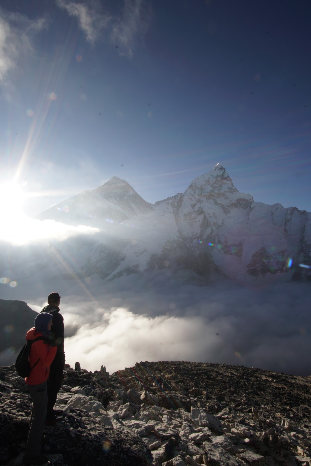
Kala Patthar was a hike from the town of Gorak Shep (5149m). We took a detour on the Everest Three Passes Trek and joined up with the Everest Base Camp Trek route in order to hike Kala Patthar and go to base camp. The elevation is 5560m. We left at 4:00am and watched the sunrise over Mount Everest.. luckily we were already acclimatized and only took 1 hr to reach the top (2nd group up there!) We had amazing inversion which we watched roll in through the valley, finally covering up the Khumbu icefall. A spectacular morning, truly one of the most amazing views of the entire Nepal trip.
Inversion rolling in! On the way up. (Photo: Lisa)
Everest (8,848m) and Nuptse (7,861m). Nuptse looks taller than Everest here because it is closer. (Photo: Lisa)
Everest and Nuptse again, inversion coming right in and touching the Khumbu Icefall now (Photo: Lisa)
Beautiful inversion. Ama Dablam (6,812m) sticking out left of center. We were up-close and personal with it on Nangkartshang Peak a few days before. (Photo: Lisa)
A Sunrise photo of Everest (Photo: JJ)
Chilly group photo with a sunrise-Everest! (Photo: JJ)
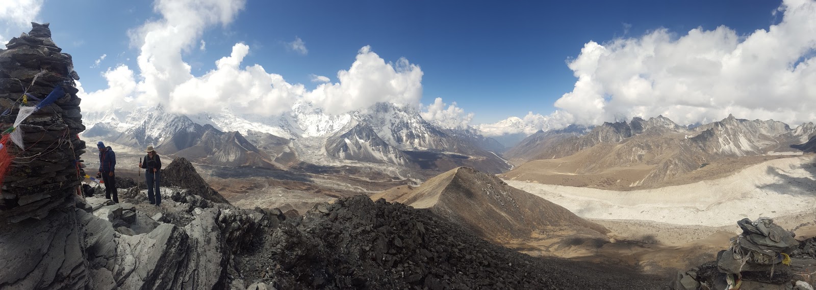
Chukkung Ri was a side trip/acclimatization hike from the town of Chukkung (4730m) on the Everest Three Passes Trek. It is about 830m up to 5560m. This was one of the highlights of the trek. There is a bit of a scramble at the top which made the hike extra fun!
On the way up. Cool cloud. (Photo: Lisa)
Summit cairns (Photo: Lisa)
Looking back the way we came from the summit (Photo: Lisa)
Huge, Huge Lhotse (8,516m) on the left. The summit is 3km above us. (Photo: Lisa)
(Photo: JJ)
Prakash with an unreal view (Photo: JJ)
Looking up the valley we have to go through tomorrow to cross Kongma La which can be seen in this photo as the pass to the farthest left (about 1/4 from the left edge of the photo) (Photo: Lisa)
Me and Jaimie coming off of the 2nd peak, lookin' like a fresh boyband (Photo: JJ)
Nangkartshang Peak was a side trip/acclimatization hike from the town of Dingboche (4260m) on the Everest Three Passes Trek. It is about ~800m up the ridge behind Dingboche. We hit 5000m on this peak! The peak was less traveled as other trekkers were not going all the way to the top. In my opinion, it is well worth it! You get an amazing view of Ama Dablam (6,812m) and solid acclimatization. You just have to be careful while doing this hike. Since it is at the beginning of the trek, you are not yet acclimatized and may not be ready to do Nangkartshang. We were pre-acclimatized for this trek after doing the Manaslu Circuit Trek just days before and were already able to reach 5000m without issues - so it is important to take it slow and not go all the way to the top if your body is not ready.
On the way up. Ama Dablam in the center. (Photo: Lisa)
Khumjung was a side trip/acclimatization hike from the town of Namche Bazar (3550m) on the Everest Three Passes Trek. It is about a 13km and ~600m loop. We went counter clockwise, visiting the Everest View Hotel (highest 5-star hotel on earth!) for tea, then circled up to Khumjung to visit the temple (which was under construction), walk by the Hillary School where the kids were outside doing the triple-jump during gym class, then back down to Namche Bazar for the afternoon.
Above Namche Bazar (Photo: JJ)
At the Everest View Hotel (Photo: JJ)
Walking around Khumjung (Photo: JJ)
Prakash and Jaimie at a prayer wheel wall (Photo: JJ)
Walking along some of the longest mane walls in the Khumbu (Photo: JJ)
Total Distance: ~200km Total Elevation Gained: ~X m Highest Elevation: 5106 m
Crew: NePALs (Jaimie, Travis, JJ)
Dates: May 3 - 14, 2017 (Kathmandu to Kathmandu*) Days of Hiking: 10
*Theoretically back to Kathmandu. We went to Dhading but would have been back in Kathmandu if we did not.
Check out this video I made with my adventure camera:
Itinerary: Day 1: Kathmandu to Soti Khola (Local Bus x2) - 700m Day 2: Soti Khola to Maccha Khola - 930m Day 3: Machha Khola to Jagat - 1340m Day 4: Jagat to Dyang - 1860m Day 5: Dyang to Namrung - 2630m Day 6: Namrung to Lho - 2957m,Monastery of Lho Day 7: Lho to Samaguan - 3530m, Birendra Lake & Manaslu Glacier Day 8: Samaguan to Samdo - 3865m, Samdo Hill Day 9: Samdo to Dharmasala (Larke Phedi) - 4460m Day 10: Dharmasala to Bimthang- 3950m - via Larke La (Pass), 5106 m Day 11: Bimthang to Dharapani - 1900m Day 12: Dharapani to Dhading (Jeep + Bus x2) The Manaslu Circuit Trek is a tea-house trek that is part of the Great Himalaya Trail. It is just east of the Annapurna Circuit and much less traveled. All the information you require on the trek can be found at http://manaslucircuittrek.com/, including finding a guide. Tip: a guide is required by regulation on this trek. We decided to carry our own packs on our trip. It seems that most groups choose to hire a porter and not as many trekkers carry their own packs. It makes for a tougher day and a stiffer back, but way more satisfaction with yourself! We found a guide using the link above and he was amazing. Definitely use this company (Magical Nepal) if you are planning anything in Nepal (treks, adventure, jungle tours, city tours, mountaineering expeditions, etc. ANYTHING!). They are amazing and go above and beyond to accommodate your travel style and making changes to your trekking itinerary if required is not a big deal. There is tons of information out there on itineraries, what to pack, what to expect, etc. so I will not get into any of that here. Tip: it is much cheaper (and more personal, flexible) to go with a private guide such as one from Magical Nepal, than an organized tour with one of the big companies. Feel free to get in touch with me if you have any questions. Our guide's name was Prakash, and this was his 27th time on the Manaslu Circuit Trek. We became great friends with him, and decided to bring him along on our next trek, the Everest Three Passes Trek. This just goes to show how awesome he was. Anyways, enough of this sales pitch for Magical Nepal. Just know I 100% think they are the greatest company and they will definitely have my business when I return. Its safe to say that my hardest day of hiking (yes, in my entire life) was the first day of the Manaslu trek. I remember thinking to myself "what did I get myself into?" "maybe I can find a porter for hire in Machha Khola?". It was the hottest, most humid, sunny, day I have experienced hiking. Not to mention it was a ~20km day. I think I drank 4L of water, JUST while hiking. Needless to say, it got much easier and more bearable as we continued. We settled into our packs and our hiking legs, the heat and humidity however was a never-ending battle. TLDR: The first 1-3 days will be HARD but if you tough it out, it gets way easier! We had great weather on most of the trek, it got cooler and less humid (thank goodness) as we got higher in elevation. We had an afternoon of rain on day 3 between Machha Khola and Jagat, which was welcomed. We also got lucky on the pass day as we were the first ones up and had beautiful weather, however the weather rolled in behind us and it looked like the rest of the trekkers who were crossing the pass did not get the same views as us. TLDR: The early start on pass days is worth it! I have to say, the food along the Manaslu trek was spectacular. If you love curry, you'll love the food on this trek. You pass through villages where people actually live, so you get the local vegetables and the local flare on dal bhat, basically what the locals eat! If you've looked into traveling in Nepal at all, you have probably already heard about dal bhat. It is a HUGE mound of rice, potato curry, curried or steamed green veggies, "pickle" (to add even more spice and flavour), and dal (lentil soup). It is all bottomless. Yes, they make a huge pot and you have to finish it all! (I would feel terrible wasting food in Nepal as well, so we would always do our best to finish it). This is amazing after a morning (or day) of hard trekking when you need to replenish those calories. Along this trek, no dal bhat is the same. Like I said, there is a bit of a local flare - in each village, they grow different vegetables, use different spices, make different pickle... so it is different every meal, and just as delicious. My favorite was a potato curry that had cheese curds in it, in Chesopani, where we stopped for lunch one day. Mmmm. TLDR: Great, flavourful food along the Manaslu Trek. So, how was the actual hiking? Awesome. You start way down at 700m and go up to 5106m so you get to experience many different types of climates and landscapes. You don't really get into the mountains until you hit Lho. Before then it's all beautiful lush, green valleys. After, you are in the sub-alpine until you cross the pass and drop into Bimthang. Anyways, pictures say more than words and I've already written many, many words. So enjoy the photos and feel free to ask if you have any questions.
Day 2 - Typical terrain on the first 5 days of hiking (Photo: JJ)
Day 2 - Lots of encounters with farm animals! (Photo: JJ)
Day 2 - Lunch could not have come any sooner this day. (Photo: JJ)
Day 2 - Donkeys taking a lower trail (Photo: JJ)
Day 3 - One of the many suspension bridges we crossed (Photo: JJ)
Day 3 - Beautiful valley (Photo: JJ)
Day 3 - Still walking... (Photo: JJ)
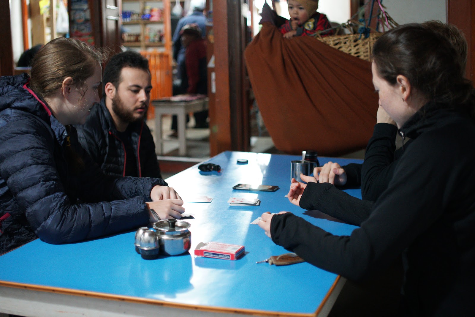
Day 4 - Always playing cards (Photo: JJ)
Day 4 - Always freaking out about spiders (Photo: JJ)
Day 5 - Making friends (Photo: JJ)
Day 5 - Don't slip.. (Photo: JJ)
Day 5 - Lots of kids come up and say hi ("Namaste"). A kid running around a Mane-Wall. (Photo: JJ)
Day 5 - Stopping for tea/lunch in Chesopani (best Dal Bhat) (Photo: JJ)
Day 5 - The beautiful valley that never ends. (Photo: JJ)
Day 5 - Don't slip #2 (Photo: JJ)
Day 5 - Amazing, etched into rock. (Photo: JJ)
Day 5 - The stairs to Namrung during golden hour. There's a solid few hundred meter hill right before Namrung. (Photo: JJ)
Day 6 - First peek of Manaslu (far left) (Photo: JJ)
Day 7 - Manaslu! (Photo: JJ)
Day 7 - Manaslu Pano (Photo: JJ)
Day 7 - Hiking with Manaslu (Photo: JJ)
Day 7 - My favorite photo from the trip (Photo: JJ)
Day 8 - Hiking to Samdo (Photo: JJ)
Day 9 - Group pic on the way to Dharmasala (Larke Phedi) (Photo: JJ)
Day 10 - Pass day, up before the sun (Photo: JJ)
Day 10 - On Larke Pass (Photo: JJ)
Day 10 - Shack Snack Break (Photo: JJ)
Day 12 - Group photo in Dharapani before leaving in the jeep (Photo: JJ)
The blue boxes show where I as when I sent messages from my GPS device to my Map Share. I sent a message at every town we slept in. (Note: There is an extra box, which is Larke La (Pass))