Sunday, 27 August 2017

Mount Kidd South

Hike Name: Mount Kidd South
Activity: Hiking 
Distance: 13 km (RT)
Altitude: 2,895
Elevation Gain: 1375 m
Area: Kananaskis Valley
Crew: Mark, Travis
Time to Summit: 3.5 hr (?)
Lisa's Mom Rating: No


Trailhead: Galatea Lakes Parking Lot


Additional Info:
The plan was to go hike Mount Rae on this gorgeous, sunny day but as soon as we turned the corner towards the Centex, we were just socked in by smoke. We pulled chute and turned around, only to stop to go up Mount Kidd South instead. We were unaware that the short cut up to Guinn's pass was destroyed in the floods and not rehabilitated, so we ended up going all the way to the lakes and up to the pass and then to the peak - much farther than we originally anticipated. It was a nice, HOT day, and a super busy trail on the main path to the trail... the lakes were very beautiful. Oh yeah, also we ran into a AB Parks Warden on our way up who showed us weasel skeletons... cool!

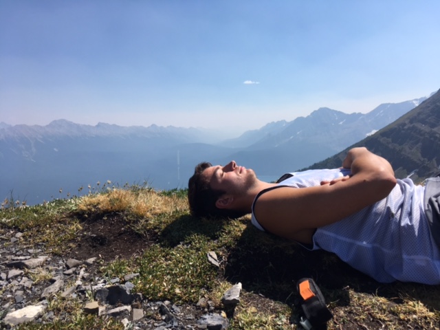
 We're best friends, I swear

 See!

 Coming back down the pass


A lake! The most refreshing lake on a day like today.

Sunday, 13 August 2017

Mount Fairview

Hike Name: Mount Fairview
Activity: Hiking 
Distance: 9.3 km (RT)
Altitude: 2,747 m
Elevation Gain: 1008 m
Area: Banff National Park (Lake Louise)
Crew: Bennett, Steph, Julia
Time to Summit: 2 hours
Lisa's Mom Rating: Yes

Trailhead: Lake Louise


Additional Info:
We wanted to hike Wenkchemna pass, as we knew the smoke would obscure summit views today. However when we got to the Moraine Lake parking lot, AS ALWAYS it was packed and we were unable to park after doing a few loops. We decided to park at Lake Louise instead and go up Mount Fairview. It started raining just as we left the summit. Perfect timing.

 Summit Pano. Temple on the left.

Looking towards St. Piran, Niblock, Whyte, and Steph.

 Bennett bein' a stud as usual

The girls and the smoke!

Sunday, 6 August 2017

Cypress Peak (Attempt)


Hike Name: Cypress Peak (Attempt)
Activity: Hiking/Scrambling
Distance: ~9km (RT)
Altitude: 2,085 m
Elevation Gain: 1,185 m
Area: Whistler, BC
Crew: Bennett, Andrew, Jaimie
Lisa's Mom Rating: No

I didn't take any photos of this hike because we didn't get high enough up to get good views (and I did NOT want to stop because the bugs would eat me alive!!!). We went as far as we could up the forestry road, and hiked ~4km and ~300m up to the trail. We found a faint trail and bushwhacked through some thick bushes and plants, ended up at a river that was quick moving with unstable big rocks as footing that we were apparently supposed to cross. However after trying to find the way for several minutes, it being super muggy and humid, still super smoky, bugs biting and buzzing into our ears, and doing two hikes the previous two days, we called it quits. We hiked back to the car and went to a lake on our way back to Squamish for a swim!

Stawamus Chief II

Hike Name: Stawamus Chief
Activity: Hiking/Scrambling
Distance: ~10 km (RT)
Altitude: ~800 m
Elevation Gain: ~700 m
Area: Squamish
Crew: Bennett, Andrew, Jaimie
Time to Summit: 1 hour to third summit, 20 minutes between third and second summit, 40 minutes between second and first summit.
Lisa's Mom Rating: Yes, depending on route

Trailhead: Stawamus Chief Parking Lot

Getting There:
Head South through Squamish and turn into the Stawamus Chief Parking lot

Additional Info:
I hiked the first peak of The Chief for sunset while visiting Mikaila a few years ago. Now, I'm in Squamish doing the Chief with Jaimie. We did Wedgemount Lake the day before, and decided to do the 3 peaks of the Chief as our "rest day" between Wedgemount and Cypress. Andrew joined us in Squamish on Friday night to make a sick crew of four!
We went directly to the third peak, which was nice because we beetled off the main Chief trail early on (and it's a Saturday so you KNOW it's busy). We sat at the top for a solid hour, saying our names backwards on a voice recording app, and rewinding it again to play it "correctly"... We then did the quick walk over to the second peak. From there we took a bit of a scramble route up to the first peak and then we were on our way down!

So smoky from Peak 3 


When boys are in the way of you and your best friend taking a pic... (Peak 1). Asil, TtenneB, Werdna, and Eimiaj.

Friday, 4 August 2017

Wedgemount Lake

Hike Name: Wedgemount Lake
Activity: Hiking 
Distance: 14 km (RT)
Altitude: 1,861 m
Elevation Gain: ~1,200 m
Area: Garibaldi Provincial Park
Crew: Bennett, Jaimie
Time to Top: 2 hours
Lisa's Mom Rating: Yes

Trailhead: Wedgemount Lake Trailhead


Additional Info:
Bennett and I visited Jaimie in Squamish for August Long Weekend. We hiked up to Wedgemount Lake - which is a 1200m hike up to a LAKE. Usually after 1200m you're on top of a big mountain in Alberta... I guess we started at sea-level out here, but wow. Anyways, it was super smoky which was too bad, however it got less smoky as we hiked higher up, and ended with a beautiful view at the lake. We spent a solid hour + lying down at the lake, and going for a dip in the chilly water..

 The hut at Wedgemount Lake

 #1 most scenic outhouse found thus far

 Jaimie and I

Signed, cheese-tray, bagged-salad, and half-chicken.

Saturday, 29 July 2017

Mount Indefatigable

Hike Name: Mount Indefatigable
Activity: Hiking/Scrambling 
Distance: ~10 km (RT)
Altitude: 2,672 m
Elevation Gain: ~1000 m
Area: Kananaskis (Kananaskis Lakes)
Crew: Bennett, Steph, Mark, Jeevan
Time to Summit: ~2.5 hours to North Summit +30 to South Summit
Lisa's Mom Rating: Yes, depending on which peak & route

Trailhead: North Interlakes

Getting There:
Heading south down Kananaskis Trail (Hwy 40) from the Trans Canada (Hwy 1), take the right-hand turn towards the Kananaskis Lakes, and continue straight on this road until the left turn towards North Interlakes. 

Additional Info:
We camped at Boulton Creek Campground for the weekend and decided to hike up Mount Indefatigable, as it has been on most of our lists for a few years. We actually meant to go to the South Summit and traverse to the North Summit (true peak) to do the full loop, but we missed the turn towards the South Summit and decided to just continue to the North one first. We ended up thinking this was the better way to do it, as the final scramble before the North Summit would be difficult (in our opinions) to scramble back down, but was OK going up. The traverse to the South Peak was somewhat easy to manage and route-find (it was usually just best to stay on top of the ridge). A fun scramble, and an AWESOME ridge-walk between summits.


 Mark relaxing at the last grassy bit on our way up to the North Summit

 Steph scrambling up to the North Summit

 Ben and I on the North Summit. Ridge to the South Summit & the South Summit in the background.

Taking photos of a fire taking off a few valleys away

 Jeevan scrambling over to the South Summit.

Scrambling along the ridge to the South Summit

 Steph ridge-walking to the South Summit

Mark and Bennett ridge-walking to the South Summit

Heading back down from the South Summit

Thursday, 27 July 2017

Rockbound Lake

Hike Name: Rockbound Lake
Activity: Hiking 
Distance: 17 km (RT)
Altitude: 2,210 m
Elevation Gain: ~800 m
Area: Banff National Park (Bow Valley)
Crew: Bennett, Steph, Travis
Time to Top: 2 hours
Lisa's Mom Rating: Yes

Trailhead: Rockbound Lake Trailhead

Getting There:
From the Trans-Canada (Hwy 1), continue past the town of Banff. Before Lake Louise, take the turnoff north towards Castle Junction. Turn right at Castle Junction and it will be your first left into the Rockbound Lake Trailhead parking lot.

Additional Info:
Bennett and I spent the previous night camping with Steph V, Emma, and a few others at the Two Jack Lake campground in Banff. They were planning on joining us to Rockbound Lake but after hiking Cascade the day before, they were exhausted (fair enough!) and opted out. The plan was to initially hike Mount Rae but as the weather was not looking good in Kananaskis, we decided to stay in the Banff area and hike to Rockbound lake with Steph H and Travis. Unfortunately I did not take many photos (just 1) but it was beautiful, and we will return to do Helena Peak!

Looking back towards Tower Lake, just before reaching Rockbound Lake.