Showing posts with label Mount. Show all posts
Showing posts with label Mount. Show all posts
Saturday, 8 February 2020

Sunday, 28 July 2019
Saturday, 6 July 2019
Saturday, 8 September 2018
Mount Tyrwhitt
Hike Name: Mount Tyrwhitt
 Activity: Hiking/Scrambling
Distance: 9.5 km (RT)
Altitude: 2,871 m
Elevation Gain: ~680 m
Area: Kananaskis Valley
Crew: Rachel
Time to Summit: ~2.5 hrs
Lisa's Mom Rating: No
Trailhead: Highwood Pass Parking Lot/Ptarmigan Cirque
Additional Info:

Sunday, 29 July 2018
Mount Rae ii
Hike Name: Mount Rae
Activity: Hiking/Scrambling
Distance: ~10 km (RT)
Altitude: 3,218 m
Elevation Gain: ~1000 m
Area: Kananaskis Valley
Crew: Stephanie
Time to Summit: ~2.5 hrs
Lisa's Mom Rating: No
Trailhead: Highwood Pass Parking Lot/Ptarmigan Cirque
Additional Info:
I have been up to the saddle on a previous trip, where we ran into snow and decided to turn around. Steph and I chose Mount Rae after realizing that the weather was absolutely perfect to do a bigger peak. This was an absolutely killer day, we had too much fun!
Note: Kananaskis Trail (Hwy 40) is seasonally closed. It closes from Peter Lougheed Provincial Park to the Highwood House Junction from December 1 to June 14 annually.

Heading up to the rock ribs to get to the saddle. Ptarmigan Cirque is around the corner to the right below.

Just above the saddle. Amazing views already!

Up on the ridge to the summit
Saturday, 23 June 2018
Mount Harvey
 Hike Name: Mount Harvey
Activity: Hiking/Scrambling
Distance: ~15 km (RT)
Altitude: 1,652 m
Elevation Gain: 1500 m
Area: Lions Gate (Vancouver, BC)
Crew: Jaimie, Steph
Time to Summit: ~3 hrs
Lisa's Mom Rating: No
Trailhead: Lions Gate
Additional Info:
Steph and I decided to visit Jaimie, Dan & Trevor over the weekend in Vancouver. We wanted to do a hike and settled on Mount Harvey - it seemed like we were going to be socked in the entire time, and as we neared the summit we started losing hope that it was going to clear up - which is disheartening after 1500m of elevation gain! Anyways. We got a few windows of views towards the ocean and snapped some photos at the summit, and on our way down it cleared more and we got some sun. Lesson learned - always sleep in! There were some groups that were on their way down as we were hiking up who only got whiteout views from the summit.

Gorgeous canopy

HUGE TREEEES

Steph & a cool dome spider web.

Our only view of the lions today...

A photogenic Jaimie running down a snow bank on the ridge to the summit

In the clouds!

Tatty

Views opening up

My scramble sistas

Clearing up more on the way down

Group pic!

Clearing up..

J'amie!

Viewpoint on the way down. Couldn't see anything here on our way up.
Saturday, 2 June 2018
Mount Buller
 Hike Name: Mount Buller
Activity: Hiking/Scrambling
Distance: ~10 km (RT)
Altitude: 2,805 m
Elevation Gain: ~1000 m
Area: Kananaskis (Spray Reservoir)
Crew: Bennett
Time to Summit: ~2 hrs
Lisa's Mom Rating: No
Trailhead: Buller Pass Trail Parking
Additional Info:
We hiked up Mount Buller after the snow finally melted enough for us to venture a little deeper into the mountains this year. We didn't encounter any snow, but the wind/clouds made it a little chilly - perhaps I was too ambitious in my short-shorts! We initially planned to do Mount Sparrowhawk, as recently there was a photo posted in a Facebook group of the summit block relatively snow-free, but after a snowfall during the week, we concluded it was probably a no-go now. We settled on Mount Buller as we drove by Sparrowhawk, and I am so happy we did. Getting a view of Sparrowhawk from the summit showed us that we would not have made it to the top that day. We had a lovely day on Buller! There is some route finding & bushwhacking after you leave the Buller Pass Trail and once you hit the saddle, you continue up to the right to reach the summit. There are some slabs to scramble up near the summit which may make some uncomfortable but we found that navigating them was alright.

Almost at the summit, view looking to the NW up the Spray Reservoir

Bean & Bass!

Starting to descend

Bam.
Saturday, 28 April 2018
Mount Baldy iii
Trip #3:
Crew: Bennett, Jon, Sam
Date: April 28, 2018
After attempting an early-season hike up Volcano Peak that was thwarted by deep snow and a lack of desire to struggle through it, we enjoyed a hike up to the bench on Baldy and basked in the sun.
Click here for the Mount Baldy Post


Crew: Bennett, Jon, Sam
Date: April 28, 2018
After attempting an early-season hike up Volcano Peak that was thwarted by deep snow and a lack of desire to struggle through it, we enjoyed a hike up to the bench on Baldy and basked in the sun.
Click here for the Mount Baldy Post


Saturday, 24 March 2018
Mount Lady Macdonald ii
Trip #3:
Crew: Ben
Date: March 24, 2018
Click here to see the Lady Mac post


Crew: Ben
Date: March 24, 2018
Click here to see the Lady Mac post

Looking down at Canmore

Towards Grotto
Sunday, 27 August 2017
Mount Kidd South
 Hike Name: Mount Kidd South
Activity: Hiking
Distance: 13 km (RT)
Altitude: 2,895
Elevation Gain: 1375 m
Area: Kananaskis Valley
Crew: Mark, Travis
Time to Summit: 3.5 hr (?)
Lisa's Mom Rating: No
Trailhead: Galatea Lakes Parking Lot
Additional Info:
The plan was to go hike Mount Rae on this gorgeous, sunny day but as soon as we turned the corner towards the Centex, we were just socked in by smoke. We pulled chute and turned around, only to stop to go up Mount Kidd South instead. We were unaware that the short cut up to Guinn's pass was destroyed in the floods and not rehabilitated, so we ended up going all the way to the lakes and up to the pass and then to the peak - much farther than we originally anticipated. It was a nice, HOT day, and a super busy trail on the main path to the trail... the lakes were very beautiful. Oh yeah, also we ran into a AB Parks Warden on our way up who showed us weasel skeletons... cool!

We're best friends, I swear

See!

Coming back down the pass

A lake! The most refreshing lake on a day like today.
Sunday, 13 August 2017
Mount Fairview
 Hike Name: Mount Fairview
Activity: Hiking
Distance: 9.3 km (RT)
Altitude: 2,747 m
Elevation Gain: 1008 m
Area: Banff National Park (Lake Louise)
Crew: Bennett, Steph, Julia
Time to Summit: 2 hours
Lisa's Mom Rating: Yes
Trailhead: Lake Louise
Additional Info:
We wanted to hike Wenkchemna pass, as we knew the smoke would obscure summit views today. However when we got to the Moraine Lake parking lot, AS ALWAYS it was packed and we were unable to park after doing a few loops. We decided to park at Lake Louise instead and go up Mount Fairview. It started raining just as we left the summit. Perfect timing.

Summit Pano. Temple on the left.

Looking towards St. Piran, Niblock, Whyte, and Steph.

Bennett bein' a stud as usual

The girls and the smoke!
Saturday, 29 July 2017
Mount Indefatigable
 Hike Name: Mount Indefatigable
Activity: Hiking/Scrambling
Distance: ~10 km (RT)
Altitude: 2,672 m
Elevation Gain: ~1000 m
Area: Kananaskis (Kananaskis Lakes)
Crew: Bennett, Steph, Mark, Jeevan
Time to Summit: ~2.5 hours to North Summit +30 to South Summit
Lisa's Mom Rating: Yes, depending on which peak & route
Trailhead: North Interlakes
Getting There:
Heading south down Kananaskis Trail (Hwy 40) from the Trans Canada (Hwy 1), take the right-hand turn towards the Kananaskis Lakes, and continue straight on this road until the left turn towards North Interlakes.
Additional Info:
We camped at Boulton Creek Campground for the weekend and decided to hike up Mount Indefatigable, as it has been on most of our lists for a few years. We actually meant to go to the South Summit and traverse to the North Summit (true peak) to do the full loop, but we missed the turn towards the South Summit and decided to just continue to the North one first. We ended up thinking this was the better way to do it, as the final scramble before the North Summit would be difficult (in our opinions) to scramble back down, but was OK going up. The traverse to the South Peak was somewhat easy to manage and route-find (it was usually just best to stay on top of the ridge). A fun scramble, and an AWESOME ridge-walk between summits.
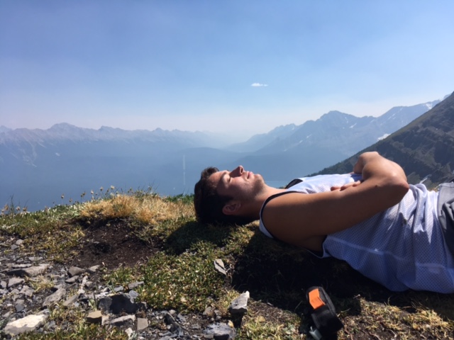
Mark relaxing at the last grassy bit on our way up to the North Summit

Steph scrambling up to the North Summit

Ben and I on the North Summit. Ridge to the South Summit & the South Summit in the background.

Taking photos of a fire taking off a few valleys away

Jeevan scrambling over to the South Summit.
 Scrambling along the ridge to the South Summit


Steph ridge-walking to the South Summit

Mark and Bennett ridge-walking to the South Summit

Heading back down from the South Summit
Subscribe to:
Posts (Atom)