Showing posts with label Bow. Show all posts
Showing posts with label Bow. Show all posts
Sunday, 9 December 2018

Saturday, 24 March 2018
Mount Lady Macdonald ii
Trip #3:
Crew: Ben
Date: March 24, 2018
Click here to see the Lady Mac post


Crew: Ben
Date: March 24, 2018
Click here to see the Lady Mac post

Looking down at Canmore

Towards Grotto
Friday, 10 November 2017
Bow Glacier Falls
 Trail Name: Bow Glacier Falls
Activity: Hiking
Distance: 9.2 km (RT)
Altitude: ~2,100 m
Elevation Gain: 180 m
Area: Icefields Parkway
Crew: Mikaila and Rachel
Time to Summit: ?
Getting There:
Heading north on the Icefields Parkway (Hwy 93), take the exit on the left at Bow Lake/Num-Ti-Jah Lodge.
Additional Info:
Mikaila was in town so we decided to go into the mountains and get our fix! We stopped at Bow Lake to check out the shore but ended up walking to Bow Glacier Falls. Gotta love a little impromptu hike! It's funny because I had all my hiking gear in the car but I ended up doing the hike in my big parka and winter boots instead of my actual gear. It started out as a walk to the lake.. progressed into a little exploring around the trail.. then turned into a 9km hike... way she goes!

Mik and I

Mik, Myself and Rayho

At Bow Lake

Hikin'.

The Falls from a distance
Saturday, 25 March 2017
Loder Peak & Doorjamb Mountain ii
Trip #2:Crew: Bennett, Mark, Laura, Evan
Date: March 25, 2017
Click here for the Loder Peak & Doorjamb Mountain Post
Date: March 25, 2017
Click here for the Loder Peak & Doorjamb Mountain Post
Sunday, 21 August 2016
Bow Peak
 Hike Name: Bow Peak
Activity: Hiking/Scrambling
Distance: 14.7km (RT)
Altitude: 2,879 m
Elevation Gain: 950m
Area: Banff (Icefields Parkway)
Crew: Travis, Zach
Time to Summit: 3 hours
Lisa's Mom Rating: Maybe
Trailhead: ~500m south of the Crowfoot Glacier Viewpoint, there is a pullout on the southbound side of the road.
Getting There:
From the Trans-Canada (Hwy 1), head north on the Icefield Parkway (Hwy 93). Continue about 30 km. It may be best to go to the Crowfoot Glacier Viewpoint then turn around and backtrack 500m to the pullout.
Additional Info:
On the first day of the summer with 0% chance of rain in the forecast (note its AUGUST 21 and leaves are turning yellow..), we decided to head out to the Icefields Parkway. We settled on Bow Peak because we brought Travis' dog, Zach. This was an awesome hike, definitely worth even just going to Crowfoot pass. Once we hit the pass, we started heading left, up Bow Peak. There's some scrambling on boulders, then a nice ridge walk to the summit.
Note: You have to ford a creek early on in the hike. The water was mid-thigh height on me in the afternoon.

Bow peak (left) from the trailhead / Hwy 93

View through the pass towards the mountains bordering Hwy 93. Temple is seen in the distance (middle)

Hector lake

Zach enjoying the view. And getting antsy to keep moving around! Mount Hector can be seen with the glacier in the middle background.

Me trying to learn how a flag works (found in summit register!). Mount Balfour with the glacier in the background.

Heading down - Zach is ready to get a move-on again! You can see how far we hiked in, with Hwy 93 on the far right. The bottom of the closer lake is where we forded the creek.
Sunday, 26 June 2016
Tunnel Mountain
 Hike Name: Tunnel Mountain
Activity: Trail Run
Distance: 4.3 km (RT)
Altitude: 1,692 m
Elevation Gain: 300m
Area: Banff (Townsite)
Crew: Solo
Time to Summit: 20 minutes
Lisa's Mom Rating: Yes
Trailhead: North side of St. Julien Road
Getting There:
Heading into Banff town from the Trans-Canada (Hwy 1), take the Main Street entrance. Turn left onto Moose street. Eventually it will turn right and split into Grizzly Street and St. Julien Road. Take St. Julien Road and the parking lot will be on the left.
Additional Info:
I was visiting my Aunt in Banff for the weekend with my family. We were planning on going to Johnston's Canyon after breakfast so I decided to get up for the sunrise and then do a quick jaunt up Tunnel Mountain since I have never done it before.

Sunrise from the third Vermilion Lake

About 50,000 cairns on the summit of Tunnel
Saturday, 25 June 2016
Wind Ridge
 Hike Name: Wind Ridge
Activity: Hiking
Distance: 12.0 km (RT)
Altitude: 2,202 m
Elevation Gain: 781m
Area: Bow Valley (Dead Man's Flats)
Crew: Jay
Time to Summit: 2 hours
Lisa's Mom Rating: Yes
Trailhead: Near the Banff Gate Mountain Resort
Getting There:
Head west on the Trans-Canada (Hwy 1), take the exit on the right into Dead Man's Flats. Take the overpass over the highway and follow the road up the hill until you reach a parking lot on the right.
Additional Info:
Jay and I enjoyed this moderately-sloped hike. The views are stunning - you can see Pigeon, Centennial Ridge, Lougheed, Windtower, Rimwall, as well as the town of Canmore, the Three Sisters, and the view East into the prairies.
Note: This area is closed from December 1 - June 15 annually for protection of elk and bighorn sheep.

Great view from near the top of Wind Ridge.

Me on an outcrop at the summit

Jay and the clouds on the summit

Looking towards Canmore from the summit
Tuesday, 21 June 2016
Mount Yamnuska iv
Trip #4:
Crew: Julia, Jaimie
Date: June 21, 2016
Time to Summit: 2:20
Click here for the Mount Yamnuska Page
We went out to Yamnuska after work on a Tuesday for a nice sunset hike. I know Yam is a popular hike but for a Tuesday evening we surprisingly (to me), we ran into another ~12 people on the mountain! Felt like a Saturday afternoon.

Jaimie on the chain section

Julia on the chain section

Me on the summit

Nice view, looking up at Yam on the way back to the car
Saturday, 28 May 2016
Mount Lawrence Grassi
 Hike Name: Mount Lawrence Grassi
Activity: Scrambling
Distance: 10 km (RT)
Altitude: 2,682 m
Elevation Gain: 1000m
Area: Kananaskis (Spray Reservoir)
Crew: Whit
Time to Summit: 2.5 hours
Lisa's Mom Rating: No
Trailhead: Goat Creek Parking Lot
Getting There:
Additional Info:
I named this in the Canmore area because Ha-Ling, Miner's Peak, and EEOR are categorized under Canmore and they all have the same trailhead.
After you go up the hill and cross the reservoir, instead of going up the Ha Ling trail, continue along the reservoir for approximately 20 minutes until you hit a big cairn, you can't miss it. Head up this trail, following the flagging/cairns. The path up is quite obvious. Near the top there is a lot of loose rock on slabs that make balance and sure-footing difficult.

Near-summit photo looking South-East

Looking down the spine

Me just after we passed the treeline
Sunday, 17 April 2016
Heart Mountain and Grant MacEwan Peak ii
Trip #2:
Crew: Steph
Date: April 17, 2016
Time to Summit:
1:35 (to Heart Mountain)
2:15 (to Grant MacEwan Peak)
Click here for the Heart Mountain and Grant MacEwan Peak page.


Crew: Steph
Date: April 17, 2016
Time to Summit:
1:35 (to Heart Mountain)
2:15 (to Grant MacEwan Peak)
Click here for the Heart Mountain and Grant MacEwan Peak page.

Looking back towards Heart Mountain (right) with Mount McGillivray on the left and the Canmore mountains in the background

Steph just after the summit of Heart Mountain
Saturday, 9 April 2016
Squaw's Tit
 Hike Name: Squaw's Tit
Activity: Hiking/Scrambling
Distance: 9.2 km (RT)
Altitude: 2,543 m
Elevation Gain: 1219 m
Area: Bow Valley (Canmore)
Crew: Ben
Time to Summit: Unknown (blog created post-hike)
Lisa's Mom Rating: No
Trailhead: Harvie Heights
Getting There:
Additional Info:
Interesting name for a mountain.. Pretty politically incorrect but a really fun hike regardless. There is decent exposure, I was a bit nervous up on the ridge but Ben coaxed me along! We had a fun day. Near the end of our hike, Ben jumped in the stream.. I'll remind you that it's April in Canada... Crazy. We ventured up the stream and found a nice waterfall, then bushwhacked back to the main trail.

Me on the ridge after we finished the scree and started on the ridgewalk
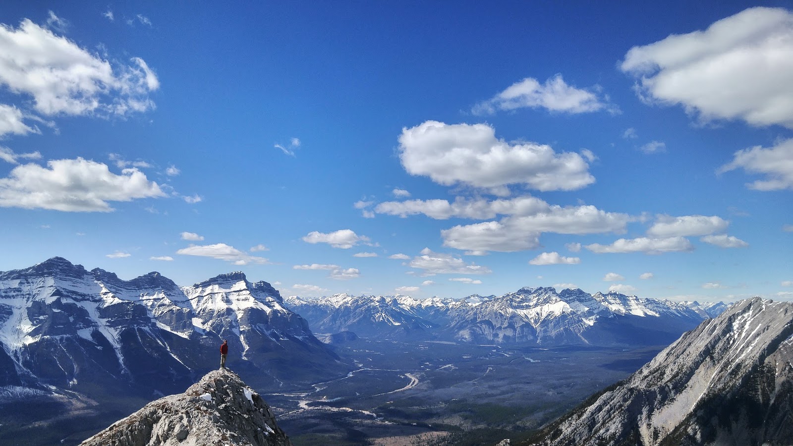
Ben on the ridge
Saturday, 2 April 2016
Gap Peak
 Hike Name: Gap Peak
Activity: Hiking/Scrambling
Distance: 9.6 km (RT)
Altitude: 2,517 m
Elevation Gain: 1197 m
Area: Bow Valley (Exshaw)
Crew: Rachel
Time to Summit: Unknown (blog created post-hike)
Lisa's Mom Rating: No
Trailhead: Bay Mag Plant Parking Area
Getting There:
Additional Info:
Follow Bob Spirko's directions. Once parked at the Bay Mag Plant, head straight across the gravel bed and into the trees. It is quite a bushwhack but if you're lucky you'll come across some flags to follow. Once above the trees, aim for the first cliff band, then follow the base of it to your right. Once the first cliff band is bypassed, you will bypass the second cliff band on the left. Go up the scree field, then ridge-walk to the summit.

Bypassing the second cliffband on the climber's left
Sunday, 20 March 2016
Grotto Mountain
 Hike Name: Grotto Mountain
Activity: Hiking/Scrambling
Distance: 8.7 km (RT)
Altitude: 2,725 m
Elevation Gain: 1373 m
Area: Bow Valley (Canmore)
Crew: Mark
Time to Summit: Unknown (blog created post-hike)
Lisa's Mom Rating: Yes
Trailhead: Alpine Club of Canada, Canmore lower parking lot.
Getting There:
Additional Info:
There are two routes up this mountain, we took the ACC route. It is very steep and you gain a lot of elevation, so be ready for a big day!
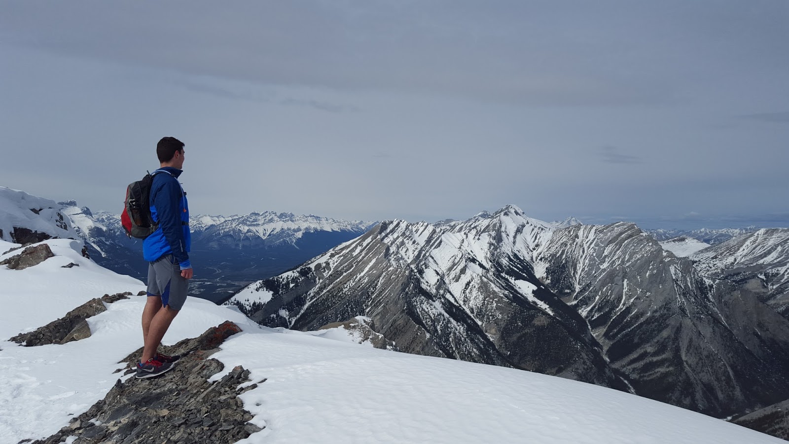
Mark on the ridge

Me on the ridge
Sunday, 13 March 2016
Loder Peak & Doorjamb Mountain
 Hike Name: Loder Peak & Doorjamb Mountain
Activity: Hiking/Scrambling
Distance: 7 km (RT)
Altitude: 1,996 m (DoorJamb) - 2,088 m (Loder)
Elevation Gain: 800m
Area: Bow Valley (Exshaw)
Crew: Steph, Trevor, Jaimie
Time to Summit: Unknown (Blog created post-hike)
Lisa's Mom Rating: Yes
Trailhead: Bay Mag Cement Plant
Getting There:
Heading west on the TransCanada (Hwy 1) from Calgary, take the exit towards Seebee/Exshaw. Continue on the 1X and then turn left (towards Canmore) on the 1A. There is a little "parking lot" at the base of DoorJamb/Loder Peak.
Additional Info:
This is a nice quick hike that is good for shoulder season hiking since it is windy and the snow has been swept away. Before Doorjamb Mountain, stick to the top of the ridge. We stayed too close to the climber's left and ended up under some slabs that were too steep to scramble up. So we back-tracked a bit and then found our way up the ridge. From here the path is clear to Loder.

Weather coming in through the Bow Valley

Trevor, Steph, and Jaimie on our way down. Doorjamb in the center.
Saturday, 2 January 2016
Miner's Peak
Hike Name: Miner's Peak
Activity: Hiking/Scrambling
 Distance: 7 km (RT)
Additional Info:

Activity: Hiking/Scrambling
Distance: 7 km (RT)
Altitude: 2,450 m
Elevation Gain: ~860m
Area: Bow Valley (Canmore)
Crew: Ben
Time to Summit: 2:00 (Time from car to Ha-Ling was 1:30 to Miner's Peak +0:30)
Lisa's Mom Rating: Yes
Trailhead: Goat Creek Day Use Area
Getting There:
From the town of Canmore, follow the signs toward the Nordic Center. Continue past the Nordic Center towards the Spray Reservoir. Eventually, you will be climbing up a hill on a gravel road that gets pretty dusty. You'll come across a parking lot on the right side of the road called "Goat Creek Day Use Area".Additional Info:
This is a great hike for the winter time. It is extremely crowded in the summer so it is nice to get some solitude up on Ha-Ling. From Ha-Ling, head East along the ridge and Miner's Peak is technically on the left. There are 3 high points to the right (Called Miner 1, 2, and 3) which are easy to get to as well!

Hitting Miners 1/2/3 after Ha-Ling and Miner's Peak
Sunday, 29 November 2015
Pigeon Mountain
 Hike Name: Pigeon Mountain
Activity: Hiking
Distance: 12 km (RT)
Altitude: 2,394 m
Elevation Gain: 1000 m
Area: Bow Valley (Dead Man's Flats)
Crew: Ben, Kris
Time to Summit: Unknown (blog created post-hike)
Lisa's Mom Rating: Yes
Trailhead: Near the Banff Gate Mountain Resort
Getting There:
Heading West on the Trans-Canada (Hwy 1), take the exit on the right into Dead Man's Flats. Take the overpass over the highway and follow the road up the hill until you reach a parking lot on the right.
Additional Info:
You hike along the cutline for quite some time, and then turn left up Pigeon. Once you've turned left, you quickly leave the trees and have the remainder of the hike in the sun. You can come down the way you went up, or continue on the ridge and then bushwhack down the old ski runs. I'd suggest finding a GPS track to stick to, because if you walk along the ridge for too long you may find yourself on top of some cliff bands.
Note: This area is closed from December 1 - June 15 annually for protection of elk and bighorn sheep.

Views open up early on

Ben and I before the summit

Looking towards Canmore. The summit is on the right (unknown hikers)
Subscribe to:
Posts (Atom)