Sunday, 20 December 2015

Powderface Trail

Activity: Trail Run
Distance: 14km (RT)
Altitude: 2,024 m
Elevation Gain: 500m
Area: Kananaskis (Bragg Creek)
Crew: Bennett, Mom
Lisa's Mom Rating: Yes
Trailhead: Winter gate closure on Highway 66

Getting There:
Go west on highway 66 until the gate closure.


Additional Info:
Beautiful (and windy!) winter day for a trail run.
You can also hike straight to the high point if you are looking for a quicker trip!
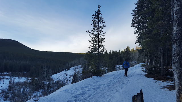
 Bennett on the trail

 Me on the trail

Bundled up in the wind

Tuesday, 15 December 2015

Tangle Ridge (Attempt)

Hike Name: Tangle Ridge
Activity: Hiking/Scrambling
Distance: Unknown (We did not reach the top. No GPS.)
Altitude: 3,001 m
Elevation Gain: Unknown (We did not reach the top. No GPS.)
Area: Columbia Icefields Parkway
Crew: Ben
Time to Summit: N/A (We did not reach the top.)
Lisa's Mom Rating: Yes


Additional Info:
This was similar to Roche Bonhomme (the day after, actually). We were on our way back to Calgary from Jasper and decided to pull over and strap on the snowshoes again. Basically once again, our energy was spent on route-finding and breaking trail for a few hours, and although we could have reached the summit if we were persistent, we still had half of our drive left and ended up turning around before our turnaround time. It was a beautiful day, and again this is a hike that I will most definitely attempt in the summer.
About 30 minutes into our hike

Monday, 14 December 2015

Maligne Canyon

Activity: Hiking/Walking
Area: Jasper
Crew: Bennett
Lisa's Mom Rating: Yes


After getting off of Roche Bonhomme, we decided to stop by Maligne Canyon and explore the boardwalk. I didn't end up taking any photos but it was beautiful in the wintertime and not crowded at all - I definitely recommend doing this one in the winter. We chatted with some of the ice climbers on the waterfalls, then hopped back in the car to head to Jasper Brewing Co. for BEER!
Beautiful winter day.

Roche Bonhomme (Attempt)

Hike Name: Roche Bonhomme
Activity: Hiking/Scrambling
Distance: Unknown (We did not reach the top. No GPS.)
Altitude: 2,495 m
Elevation Gain: ~750m (turnaround point)
Area: Jasper
Crew: Ben
Time to Summit: N/A (We did not reach the top.)
Lisa's Mom Rating: Yes


Additional Info:
We attempted this in winter so it was a slog. Ben was breaking trail in snow shoes, so we (he) did a lot of route finding and again, breaking trail, so it was exhausting and we didn't move too quickly. After a few hours and finally getting a glimpse of the peak through the trees (we were in the trees the entire time), we realized we were only half-way there elevation-wise, approx. 750m. So we turned around and of course we got down in half of the time with the obvious trail and downhill. We had fun anyways!


I'd love to do this again in the summer, it would be much more practical!

Sunday, 13 December 2015

Moab Lake


Activity: X-Country Skiing
Distance: 14km (RT)
Area: Jasper (Icefield Parkway)
Crew: Ben
Lisa's Mom Rating: Yes


Bennett and I cross country skied to Moab Lake. It was such a beautiful day with the perfect temperature (okay, maybe on the cold side). It is trackset up until ~300m before the lake so you have to do some trail blazing/bushwhacking for the last bit but it is definitely worth it! I would love to go back...
Blazing Trail to the lake!

Saturday, 12 December 2015

Beauvert Lake


Name: Beauvert Lake
Activity: Ice Skating
Area: Jasper
Crew: Bennett

Where:
At the Jasper Park Lodge just outside of town.


Additional Info:
On the night we got into Jasper, we decided to check out the lake to skate on! Since it was the first night that it was open for skating, there was only a small section that was smooth - a path around the lake was shoveled off, but super bumpy. We skated around for about half an hour and then decided to warm up at the lodge!
Don't forget your headlamp!
This is the only photo I have from this night, from the car, driving towards Jasper Park Lodge. Again, it was dark. Bring a headlamp!

Saturday, 5 December 2015

Prairie Creek Trail


Activity: Trail Run
Distance: 12.5km (RT)
Elevation Gain: ~300m
Area: Kananaskis (Bragg Creek)
Crew: Mom
Lisa's Mom Rating: Yes
Trailhead: Winter gate closure on Highway 66

Getting There:
Go west on highway 66 until the gate closure.


Additional Info:
A warm winter day for a solid trail run in Bragg Creek with my mom!
 Mom on the trail

Bye sun!