Saturday, 29 July 2017

Mount Indefatigable

Hike Name: Mount Indefatigable
Activity: Hiking/Scrambling 
Distance: ~10 km (RT)
Altitude: 2,672 m
Elevation Gain: ~1000 m
Area: Kananaskis (Kananaskis Lakes)
Crew: Bennett, Steph, Mark, Jeevan
Time to Summit: ~2.5 hours to North Summit +30 to South Summit
Lisa's Mom Rating: Yes, depending on which peak & route

Trailhead: North Interlakes

Getting There:
Heading south down Kananaskis Trail (Hwy 40) from the Trans Canada (Hwy 1), take the right-hand turn towards the Kananaskis Lakes, and continue straight on this road until the left turn towards North Interlakes. 

Additional Info:
We camped at Boulton Creek Campground for the weekend and decided to hike up Mount Indefatigable, as it has been on most of our lists for a few years. We actually meant to go to the South Summit and traverse to the North Summit (true peak) to do the full loop, but we missed the turn towards the South Summit and decided to just continue to the North one first. We ended up thinking this was the better way to do it, as the final scramble before the North Summit would be difficult (in our opinions) to scramble back down, but was OK going up. The traverse to the South Peak was somewhat easy to manage and route-find (it was usually just best to stay on top of the ridge). A fun scramble, and an AWESOME ridge-walk between summits.


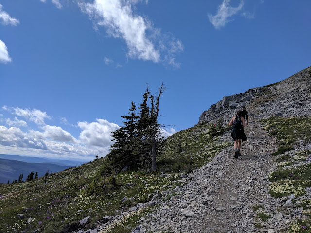
 Mark relaxing at the last grassy bit on our way up to the North Summit

 Steph scrambling up to the North Summit

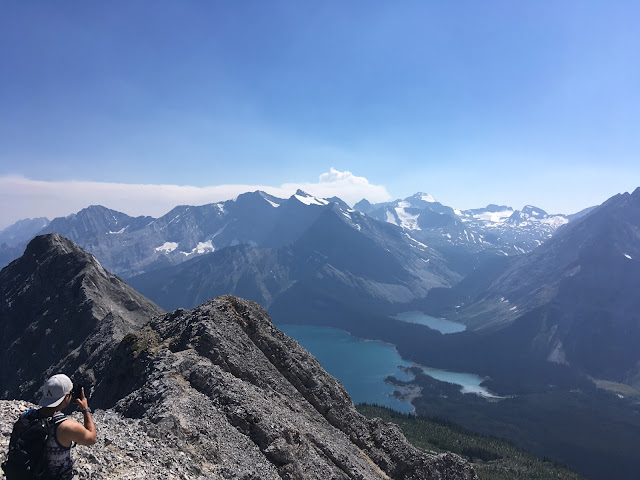
 Ben and I on the North Summit. Ridge to the South Summit & the South Summit in the background.

Taking photos of a fire taking off a few valleys away

 Jeevan scrambling over to the South Summit.

Scrambling along the ridge to the South Summit

 Steph ridge-walking to the South Summit

Mark and Bennett ridge-walking to the South Summit

Heading back down from the South Summit

Thursday, 27 July 2017

Rockbound Lake

Hike Name: Rockbound Lake
Activity: Hiking 
Distance: 17 km (RT)
Altitude: 2,210 m
Elevation Gain: ~800 m
Area: Banff National Park (Bow Valley)
Crew: Bennett, Steph, Travis
Time to Top: 2 hours
Lisa's Mom Rating: Yes

Trailhead: Rockbound Lake Trailhead

Getting There:
From the Trans-Canada (Hwy 1), continue past the town of Banff. Before Lake Louise, take the turnoff north towards Castle Junction. Turn right at Castle Junction and it will be your first left into the Rockbound Lake Trailhead parking lot.

Additional Info:
Bennett and I spent the previous night camping with Steph V, Emma, and a few others at the Two Jack Lake campground in Banff. They were planning on joining us to Rockbound Lake but after hiking Cascade the day before, they were exhausted (fair enough!) and opted out. The plan was to initially hike Mount Rae but as the weather was not looking good in Kananaskis, we decided to stay in the Banff area and hike to Rockbound lake with Steph H and Travis. Unfortunately I did not take many photos (just 1) but it was beautiful, and we will return to do Helena Peak!

Looking back towards Tower Lake, just before reaching Rockbound Lake.

Sunday, 16 July 2017

Ship's Prow

Hike Name: Ship's Prow
Activity: Hiking/Scrambling 
Distance: ~3 km (RT)
Altitude: 2,607 m
Elevation Gain: ~1000 m
Area: Kananaskis (Spray Reservoir)
Crew: Bennett, Steph V, Emma
Time to Summit: 3.5 hours to turn-around point on ridge
Lisa's Mom Rating: No

Trailhead: As soon as you cross the first bridge on the Smith Dorrien coming from Canmore.

Getting There:
From the Trans-Canada (Hwy 1), turn off towards the Nordic Center and continue on this road past the Goat Creek Parking lot and along the Spray Reservoir. Pull over on the left (There is a little parking area) as soon as you cross the canal. 

Additional Info:
We wanted to do a quick hike with Steph and her friend Emma because a few of us had to be back in the city by 5pm. We thought Ship's Prow would be a quick one but due to the bushwhacking and route-finding, it took us 3.5 hours just to reach the ridge! We were expecting a 4 - 4.5 hour day total. We followed a GPS track up the creek/drainage which worked well but it was slow moving as the terrain wasn't easy to mindlessly hike up. It spit us out under the ridge and we had to scramble up and boulder hop up to the ridge. I definitely recommend the other bushwhack route, it might be a little quicker - and it will be a little easier, I think. We came down that way and the bushes were never too, too thick - there was just no trail.

 Ridge Stretches

 3 sisters

 Mount Assiniboine peeking out

Three sisters again

Saturday, 15 July 2017

Mount Lougheed

Hike Name: Mount Lougheed
Activity: Hiking/Scrambling 
Distance: ~13 km (RT)
Altitude: 3,105 m
Elevation Gain: ~1380 m
Area: Kananaskis (Spray Reservoir)
Crew: Bennett
Time to Summit: 3.5 hours
Lisa's Mom Rating: No

Trailhead: Side of the road on the Smith Dorrien.

Getting There:
From the Trans-Canada (Hwy 1), turn off towards the Nordic Center and continue on this road past the Goat Creek Parking lot and along the Spray Reservoir. Pull over on either side of the road. 

Additional Info:
Bennett and I decided to take it easy one morning. We woke up at 830am, and left the house at 10am.. we were planning on doing Mount Jimmy Simpson, but there were some forest fires in the area so we decided not to go too close in case the smoke obscured our views. We still wanted a big hike so we settled on a mountain high on our list - Mount Lougheed! We only saw 2 groups of people this day (it was a Saturday so we were surprised!) but maybe we started late enough that we missed most of the groups.. awesome hike, great views, definitely recommend it!


 Hiking up the initial scree

Eon, Aye, and Assiniboine while walking the ridge back towards the scree bowls

Us and the ridge to Lougheed 1 behind

On the summit. Lougheed 3 is the directly connected ridge, and behind it is Wind Mountain. Right behind Bennett is Sparrowhawk.

 Hiking back out to the car

Monday, 3 July 2017

Coliseum Mountain

Hike Name: Coliseum Mountain
Activity: Hiking
Distance: ~13 km (RT)
Altitude: 2,045 m
Elevation Gain: ~680 m
Area: David Thompson Highway (Nordegg)
Crew: Bennett, Kris, Jaimie
Time to Summit: ~2 hours
Lisa's Mom Rating: Yes

Trailhead: Coliseum Trail Trailhead

Getting There:
West of Nordegg on the David Thompson Highway (Hwy 11), follow the signs to Coliseum Trail.

Additional Info:
We were on our way back from Valemont after hiking out of the Berg Lake Trail. We decided to split the drive and stop along the David Thompson Highway to camp for the night and hike the next day before returning to Calgary. We stayed at the Two O'Clock Creek Campground and hiked up Coliseum in the morning before stopping by the Shunda Fire Base to say hi to some of Bennett's friends and head home.


Bennett and I hiking up the summit block

Sunday, 2 July 2017

Berg Lake Trail (Overnight)


Name: The Berg Lake Trail
Activity: Backcountry Camping/Backpacking
Total Distance: 56 km
# Nights: 2
Date: June 30 - July 2, 2017
Area: Mount Robson Provincial Park, BC
Crew: Ben, Kris, Julia, Jaimie, Steph, Jeevan
Trailhead: Berg Lake Trail Trailhead


Route: 
Day 1 - Trailhead to Berg Lake Campground (21km, 880m)
Day 2 - Berg Lake Campground to Robson Pass Campground (2km, ~0m), Mumm Basin & Toboggan Falls Hike (10km, ~550m)
Day 3 - Robson Pass Campground to Trailhead (23km, -880m)

We did the Berg Lake Trail in Mount Robson Provincial Park, BC between Jasper and Valemount for Canada day. This is a world-renowned hiking trail so as you could imagine, it was quite busy over the Canada day-long weekend. We booked back in November but still could not get Berg Lake for both nights of our trip, so we ended up moving only 2km up to the Robson Pass Campground for the second night.

We had beautiful weather on the entire trip, save one ~1.5hr thunderstorm on the second day. We left Calgary on Wednesday morning, taking our time as we drove up the Icefields Parkway. We stopped at Horseshoe Lake to do a bit of cliff jumping (must come back again when we have more time!) then made our way to the Robson Meadows Campground to spend the night. You have to check-in at the Visitor Center prior to beginning the trail (if you are staying overnight). We did this the day before, but you could also do it quickly in the morning before beginning the hike if required. Robson Meadows Campground is right across the highway from the Visitor Center (which is just down the road from the trailhead), so it was a great place to spend the night. Firewood can be bought at $10 per wheelbarrow.

The next day, hiking up to Berg Lake was probably the most beautiful hike I have ever done. I can see why it is world-renowned. There is never a dull moment on the trail, from beautiful glacier lakes to waterfalls, green valleys, then of course the glaciers and Berg lake itself. There is a "nice" 4 km grind uphill between the Whitehorn and Marmot Campgrounds where there is no water and a constant uphill grade (still beautiful views though!). The next day, we moved our tent to Robson Pass and set out on the beautiful hike to Mumm Basin & Toboggan Falls. It starts/ends at Robson Pass and ends/starts at the Berg Lake campground. It was solid uphill for the first few km, rising above the Robson Pass campground, getting a higher and more beautiful view of Berg Lake, Berg Glacier, and Mount Robson. We saw Mumm Basin, "The" Cave and Toboggan Falls, then looped back towards Robson Pass campground, where we missed a thunderstorm rolling in behind us by mere seconds, taking refuge under the already set-up tarps around the cooking area.

We hiked out on the third day, another beautiful, sunny day and went to the Jasper Brewing Co. for some well deserved burgers and beer. From there Bennett, Kris. Jaimie and myself spent the night along the David Thompson Highway before hiking Coliseum Mountain. I would love to return and do the Snowbird Pass hike and continue up Tatei Ridge and Titakana Peak.

Again, this was probably the most beautiful hike I have ever done, so brace yourself for TONS of pics!


Day 1 - Pre-hike group pic (Photo: Jeevan)


Day 1 - Jaimie on a river crossing after Kinney campground (Photo: Lisa)

Day 1 - Steph crossing the river right before Whitehorn (Photo: Jaimie)

Day 1 - One of many waterfalls along the hike in (Photo: Lisa)

Day 1 - Emperor Falls (Photo: Jaimie)

Day 1 - Hiking in (Photo: Jaimie)

Day 2 - Happy Canada Day!! (Photo: Jaimie)

Day 2 - Group pic (sans Julia :( ) on the way up to Mumm Basin (Photo: Lisa)

Day 2 - Robson. Damn. (Photo: Jaimie)

Day 2 - Looking towards Snowbird Pass and Robson Glacier (Photo: Jaimie)

Day 2 - Jeevan at Mumm Basin (Photo: Jaimie)


Day 2 - Hiking from Mumm Basin to Toboggan Falls (Photo: Jeevan)

Day 3 - Group pic on the hike out (Photo: Lisa)