Sunday, 17 July 2016

Mist Mountain (Attempt)


Hike Name: Mist Mountain (Attempt)
Activity: Hiking/Scrambling
Distance: ~12km (RT)
Altitude: 3,143 m (at summit) 2,948 (our turnaround point)
Elevation Gain: 1,330m (to summit) ~1,200m (our turnaround point)
Area: Kananaskis Valley
Crew: Travis, Stephen
Time to Summit: 2.5 (our turnaround point)
Lisa's Mom Rating: No
Trailhead: ~600m south of the Mount Lipsett Trailhead, there is a shoulder area to park on.

Getting There:
From the Trans-Canada (Hwy 1), head south on Kananaskis Trail (Hwy 40). Continue past the turnoff to the Smith-Dorrien. The trailhead is about ten minutes past Ptarmigan Cirque.

Additional Info:
We had to turn around pretty close to the summit, due to a thunderstorm rolling in. It was pretty disheartening but definitely the right choice. We will definitely come back to summit Mist and of course to bathe in the warm-springs!
 Our first glimpse of the false summit of Mist Mountain

 Snowing where we are. Storm on the right. And to our left we have...

To the left is this storm. When you hear & see this coming at you quick, it's time to go. Especially when the last death on this mountain was due to a lightening strike.

 Snow in July. I love the mountains!

Look how high we already were! Still ~100 vertical meters from the summit.

 Travis on our way back down
 
Beautiful valley on our way down. The peak of mist was thunder storming by this time, I'm glad we left.

Monday, 11 July 2016

Mount Assiniboine Provincial Park (Overnight)


Name: Lake Magog Backcountry Campground
Activity: Backcountry Camping/Backpacking
Total Distance: 112 km
# Nights: 4
Date: July 7-11, 2016
Area: Mount Assiniboine Provincial Park
Crew: Stephanie, Jaimie, Travis, Stephen
Trailhead: Mount Shark Trailhead


Route: 
Day 1 - Mount Shark Trailhead to Lake Magog Campground (ele. 2200m) via Assiniboine Pass (29km)
Day 2 - Summit the Nub Peak (2755m) and Sunburst Peak (2830m)
Day 3 - Summit Wonder Peak (2852m) and traverse to Mount Cautley (2880m) attempt, foiled by a rain storm!
Day 4 - Summit Windy Ridge (?m) and Cave Mountain (2651m) then swim in Lake Magog
Day 5 - Hike out to Mount Shark Trailhead via Wonder Pass (27km)


We stayed at the Lake Magog Campground for the 4 nights of our stay at Assiniboine (it was our ABC - Assiniboine Base Camp!). It is a lovely campground, and feels luxurious for the backcountry. There is a covered cooking shelter with 4 picnic tables, and a water tap which we still filtered, but a lot of people didn't. They have bear lockers and bear hangers. Many outhouses that are surprisingly well maintained (toilet paper too!). It is a busy campground with 29 tent pads and an overflow area. The campground is nestled into the far end of Lake Magog, close to Mount Assiniboine herself, and right below the Sunburst Peaks.
The hike in felt surprisingly easy - perhaps I built it up in my mind to be huge and difficult, but the time passed quickly as we chatted and made our way to Assiniboine pass. It took us 7 hours (including breaks) to reach the Assiniboine Lodge, and from there it was another 2km to the campground. (May I note that Jaimie is a beast and she did the hike-in in 5 hours total)
The hike out through Wonder Pass felt more challenging, mainly because of 1. It was raining the entire time, 2. The excitement we had on the hike-in was far greater than our need to take off our boots and go eat ribs and pizza on the hike-out, 3. After four days of long treks and double peak days, we were understandably tuckered out. In the end, we travelled for 8 hours to reach the cars at the Mount Shark Trailhead (including a nice long lunch break in the Bryant Creek Cabin to dry off a bit and change our socks!).
Overall this trip was absolutely unreal, from the views, the scrambles, the squad (!), the campground, the park, the card games before bed (we were all presidents and assholes, Stephen was naturally the most merciful president), etc.
This is an adventure I will never forget, a park that I will most definitely return to, and a crew of people that hold an even more special place in my heart now - after we shared this wonderful experience together!!
 Jaimie and I warming up in the sun after going for a dip in the Lake. You can see Steph, Travis and Stephen by the shore on the bottom right. (Day 4)

 
 Me, Mount Magog, and Mount Assiniboine (top), Jaimie and I in Lake Magog (bottom) (Day 4)

Cooking in the cooking shelter (Day 3)

Hanging out on the Niblet. Left to Right - Jaimie, Steph, Me, Travis, Stephen (Day 2)

Sunday, 10 July 2016

Cave Mountain


Hike Name: Cave Mountain
Activity: Hiking/Scrambling
Distance: ~12km (RT)
Altitude: 2,651 m
Elevation Gain: ~500m
Area: Mount Assiniboine Provincial Park
Crew: Travis, Stephen
Time to Summit: 45 minutes from Og Pass
Lisa's Mom Rating: Yes
Trailhead: Lake Magog Backcountry Campground

Getting There:
See the link below in "Additional Info".

Additional Info:
This hike was on Day 4 of our Mount Assiniboine backpacking trip. After Windy Ridge, it was only noon. We looked across the valley and noticed that Cave Mountain looked very easy to ascend. So we decided to scope out the route and found an easy way to get up past the first cliff band, and noticed that the rest of the hike would be easy, but a scree slog. Not even an hour later we were at the summit!
 View of Assiniboine and the surrounding mountains from Cave Mountain

Steve at the cairn that missed the mark of the summit... It's about 100 horizontal meters away from the true summit.

Windy Ridge


Hike Name: Windy Ridge
Activity: Hiking/Scrambling
Distance: ~14km (RT)
Altitude: ? m
Elevation Gain: ~?m
Area: Mount Assiniboine Provincial Park
Crew: Travis, Stephen
Time to Summit: Unknown (didn't keep track)
Lisa's Mom Rating: Yes to the pass, Maybe to the summit
Trailhead: Lake Magog Backcountry Campground

Getting There:
See the link below in "Additional Info".

Additional Info:
This hike was on Day 4 of our Mount Assiniboine backpacking trip. Windy Ridge is another popular hike in the Assiniboine area, however we saw no other people on this day (it was Sunday so we assumed that most people left, as Sunday is a helicopter day). Sadly, Steph's heel was in pain and Jaimie's hip and blisters (seriously the worst blisters known to man) were too much to bear so they turned around in order to rest up for the hike-out the next day. Stephen, Travis and I continued onto Windy Ridge. The views are stunning from the top!
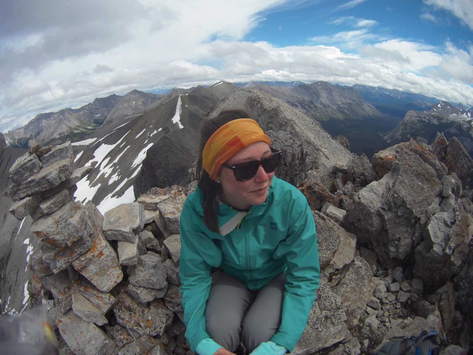
 Me on Windy Ridge

 Windy Ridge Views

 Looking back up at the boys on the way down Windy Ridge. Travis is on the narrow section.

 Mount Assiniboine from Windy Ridge, stuck in the clouds.

Saturday, 9 July 2016

Wonder Peak to Mount Cautley Traverse


Hike Name: Wonder Peak to Mount Cautley Traverse
Activity: Scrambling
Distance: ~20km (RT)
Altitude: Wonder Peak 2,852 m (Summited), Mount Cautley 2,880 m (Attempt)
Elevation Gain: ~1200m
Area: Mount Assiniboine Provincial Park
Crew: Stephen, Jaimie, Travis, Stephanie
Time to Summit: Unknown (didn't keep track)
Lisa's Mom Rating: No
Trailhead: Lake Magog Backcountry Campground

Getting There:
See the link below in "Additional Info".

Additional Info:
This hike was on Day 3 of our Mount Assiniboine backpacking trip. The weather looked gloomy at breakfast but we decided to head over to Wonder Pass to re-evaluate the clouds once we arrived. The weather looked ok so we headed up Wonder Peak, which was an awesome scramble by the way, when the sun came through the clouds. We were able to enjoy a summit-hang-out and then continued along the ridge to Mount Cautley. Apparently we were the first of the season (following 1 group ahead of us) to complete the traverse, as there is still a cornice on one section of the ridge. We scrambled around it and finally made it through the tricky sections of the ridge, when we saw a rainstorm rolling in. At about 100 vertical meters from the summit of Mount Cautley, we decided it was smart to head down so we scree-skied down into the valley - fastest summit ditch ever! The rain was pouring down on us at the bottom so we stopped at the Assiniboine Lodge for some tea. Of course the rest of the day was sunny and hot so we enjoyed our evening at the campsite.
This was definitely my favorite day of the trip - a day with the whole crew and an awesome scramble!
 Pausing on a cliff near the summit of Wonder. Clear view of Mount Assiniboine. In the valley to the left is Marvel Lake (lower lake) and Gloria Lake (upper lake)

 Jaimie on the summit of Wonder Peak, Assiniboine shrouded in clouds in the background.

 Me on the summit of Wonder Peak

 A clear Mount Assiniboine. Near the summit of Wonder Peak.

 Jaimie and Steph looking good as always! Picture taken right after the final scramble to the summit of Wonder Peak.

 Jaimie, Steve, and Steph on the summit of Wonder Peak

Storm rolling in when we were almost at Cautley. You can hardly see Assiniboine. Wonder on the left.

Friday, 8 July 2016

Sunburst Peak


Hike Name: Sunburst Peak
Activity: Scrambling
Distance: ~5km (RT)
Altitude: 2,830 m
Elevation Gain: ~650m
Area: Mount Assiniboine Provincial Park
Crew: Travis, Stephen
Time to Summit: Unknown (didn't keep track)
Lisa's Mom Rating: No
Trailhead: Lake Magog Backcountry Campground

Getting There:
See the link below in "Additional Info".

Additional Info:
This hike was on Day 2 of our Mount Assiniboine backpacking trip. After we finished The Nub, the sun was shining and I had so much energy so the boys decided they would scramble up Sunburst Peak with me. It was a fun scramble with bushwhacking, boulder fields, and route-finding through cliff bands. The summit view was amazing and the scramble was loads of fun! We missed the girls though!
Travis and Stephen on the summit of Sunburst with Assiniboine in the background

 Looking over the edge at Cerulean Lake (left) and Sunburst Lake (right)

 Summit register signed! Not many people scramble up here. It appears that a someone summited the day before us, but their tracks were washed away by the rain from the night before.
 
Stephen scrambling back down one of the cliff bands

The Nub Peak


Hike Name: The Nub
Activity: Hiking/Scrambling
Distance: 8 km (RT)
Altitude: 2,775 m
Elevation Gain: ~700m
Area: Mount Assiniboine Provincial Park
Crew: Jaimie, Steph, Stephen, Travis
Time to Summit: Unknown (didn't keep track)
Lisa's Mom Rating: Yes
Trailhead: Lake Magog Backcountry Campground

Getting There:
See the link below in "Additional Info".

Additional Info:
This hike was on Day 2 of our Mount Assiniboine backpacking trip. Our first hike of the trip was the most popular/scenic hike with the classic view of Mount Assiniboine over Sunburst and Cerulean Lakes - the Nub Peak. This was a beautiful hike and I can certainly see why it is so popular. For the work put in, the views are amazing! We were at the top of the Nub Peak when the clouds cleared over Mount Assiniboine.
 Travis up on the ridge to Nub Peak

 Me on the summit of The Nub

The classic view of Mount Assiniboine seen from the Nub. Front lake is Elizabeth Lake, behind it is Cerulean Lake, then Sunburst Lake, and Lake Magog far off in the distance. The mountain in front of Assiniboine is Sunburst Peak.